Chris Mahar
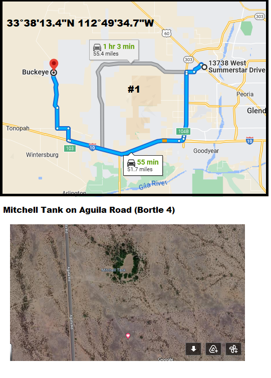
33°38’13.4″N 112°49’34.7″W
Take I-10 West. Exit at 339th Ave (Travel America) and go north.
Turn Left at Indian School. Turn Right (north) at Aguila Road (the solar plant).
Go past the 3.3 miles CAP canal. You’ll see a clump of trees on the right (east) side of the road. That’s Mitchell Tank. If it’s dark, look for drag racing marks on the pavement. Sometimes kids use the paved road for drag racing b/c it’s so straight and flat.
Turn right (east) off the pavement. It’s flat dirt and desert pavement (flat rocky surface). Turn right (south) before the barbed wire fence surrounding Mitchell Tank. I usually go a couple hundred yards to the south. Nice and flat, could accommodate many cars.
Lights of Phoenix are somewhat blocked by the White Tank mountains, but still, the eastern third of the sky isn’t usable.
I wouldn’t use this site after a big rain. It would be muddy. This land is an incorporated part of Buckeye. The water hole is controlled by Game & Fish.
